Village Mutenitsa
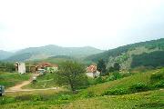
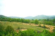
 The village of Matenitsa is situated at a distance of 5 km of Starosel Thracian temple and 20 km east from the town of Hissarya.
 There are a lot of dams in the area and the village of Matenitsa is suitable for fishing place.
The beatuful nature and location near Sredna Gora Mountain gives oprtinuty for bird watching, trekking, photographing wild plants and flowers, herbal and mushrooms picking, excursion to the Thracian temples
Matenitsa is perfect vacation amidst the quietness and the peace of province.
Quick facts about Village Mutenitsa
In Bulgarian (Native transliteraion): Село МътеницаOther transliteration(s): Mutenica, Mutenitza, Matenitsa, Matenica
Region: South-Central planing region of Bulgaria
District: Plovdiv district
Municipality: Hissarya municipality
Latitude: 42.5166702
Longtitude: 24.6166706
Altitude: from 100 to 199
Distance by air to the capital city Sofia: 107.968km
Area Size: 33.035km2
Population: 81 people (31.12.2013)
Postal Code: 4176
Phone Code: 03173


