
Municipality Sadovo

Photo: wikimapia.org
The territory of Sadovo Municipality is traversed by international road Е-80 and the international railway line Istanbul - Munich. The transport network is of 108 km length, including 36 km of fourth-class roads.
The largest river flowing through the municipality is the Maritsa.
Natural and culture sights in municipality Sadovo are: Martvitsata protected area in the land of Popovitsa village, the Fossil Finds natural sight (91sq.km area), remains of vertebrata, the Malkite Ostrovi (small islands - locality that preserves the natural habitats of birds nesting in colonies, like small cormorant, night heron, little egret, etc.), Saint Nicola church built in 1834 is in Katounitsa village.
Quick facts about Municipality Sadovo
In Bulgarian (Native transliteraion): Община СадовоRegion: South-Central planing region of Bulgaria
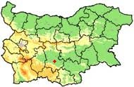
District: Plovdiv district
Municipality: Sadovo municipality
Latitude: 42.1329994
Longtitude: 24.9330006
Altitude: 3
Population: 15333 people (2005)
Photos Municipality Sadovo (28) »


News Municipality Sadovo (2) »
2011-09-24 Protests and outrages over the properties of the roma leader tsar Kiro in village of Katunitsa (Accidents)
2009-11-03 Illegal alcohol distillery broken in village of Katunitsa (Accidents)
External links Municipality Sadovo
www.sadovo.com (Sadovo)
Map of Municipality Sadovo »
Location
РЕМОНТИ Пловдив
