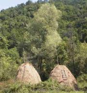
Village Protopopintsi

Photo: Chuprene municipality
History: There are two main versions for the origin of the village name. The first is that the village was named after the man named Protopop. The second is - village name comes from "pro-" ("protiv" = against) and "Popintsi" - priests.
Sightseeing:
- Near the village are several situated pools with a depth of 6 meters - Upper and Lower Bobuk.
- In the yards of some houses and in the whole region there are rocks that are part of the Belogradchik rocks, but with smaller sizes and varied in color and shape.
- Near the village is the peak named Petin.
Quick facts about Village Protopopintsi
In Bulgarian (Native transliteraion): Село ПротопопинциOther transliteration(s): Protopopinci, Protopopintzi
Region: North-Western planing region of Bulgaria
District: Vidin district
Municipality: Chuprene municipality
Latitude: 43.5625000
Longtitude: 22.7505550
Altitude: from 200 to 299
Distance by air to the capital city Sofia: 108.057km
Area Size: 10.296km2
Population: 38 people (31.12.2013)
Postal Code: 3957
Phone Code: 09327


