Municipality Nikolaevo

Photo: DaktaJones
The climate is temperate-continental with mild winters and fresh summers. Тhe abundance of green areas and water basins, the nearby mountains and the absence of large industrial polluters contribute to keep the environment in the municipality clean and healthy.
The Municipality is crossed by: main road No. 1 Sofia - Bourgas, the Sub-Balkan railway line Sofia - Bourgas; the International road Svilengrad - Rousse. The the Republic Pass (Prohoda na Republikata) passes 2 km to the east of the Municipality Nikolaevo.
Quick facts about Municipality Nikolaevo
In Bulgarian (Native transliteraion): Община НиколаевоRegion: South-Eastern planing region of Bulgaria
District: Stara Zagora district
Municipality: Nikolaevo municipality
Latitude: 42.6329994
Longtitude: 25.7999992
Altitude: 4
Population: 5092 people (2005)
Sights & Landmarks Municipality Nikolaevo (4) »
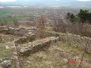
Nikolaevo: Fortress Assara
Nikolaevo: Memorial of Prof.Nikolay Genchev
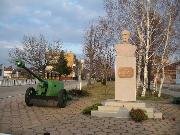
Nikolaevo: Bust monument of general Nikolai Nikolaevich
Nikolaevo: "St. Cyril and Methodiy" church
Photos Municipality Nikolaevo (9) »
News Municipality Nikolaevo (2) »
2010-06-29 The Asara hill and the fortress near town of Nikolaevo (Travel)
2009-10-21 Illegal cigarettes seized in town of Nikolaevo (Accidents)
External links Municipality Nikolaevo
www.szeda.bg (Nikolaevo)


