
Municipality Borino
 Municipality of Borino is situated in the southwestern part of the Rodopi mountains and covers an area of 167 sq. km. (5.2 % of the territory of Smolyan region). The average altitude is 1050-1600 m. The municipality is 70 km away from Smolyan sharing common borders with the municipalities of Devin and Dospat, and it borders on Greece to the south.
 The relief is mountainous. Forestry is one of the advantages of the municipality. The big reserve of trees is a background for tourism development and timber and wood processing.
The Climate is transient-continental, mildly warm.
Quick facts about Municipality Borino
In Bulgarian (Native transliteraion): Община БориноRegion: South-Central planing region of Bulgaria
District: Smolyan district
Municipality: Borino municipality
Latitude: 41.6829987
Longtitude: 24.2830009
Altitude: 8
Area Size: 167km2
Population: 4554 people (2005)
Sights & Landmarks Municipality Borino (5) »
Borino: Rock Phenomenon The Devil Bridge
Borino: Roman bridge "Kemera"
Borino: Nature Reserve of Kastrakli
Yagodina: Yagodinska cave
Buynovo: The Buinovo Gorge
Photos Municipality Borino (66) »


News Municipality Borino (4) »
2009-10-28 Natural landmarks around Buynovo (Travel)
2009-08-21 Treasure hunters destroyed an ancient bridge in village of Borino (Accidents)
2009-02-20 Devil Bridge - a phenomenon near Borino (Other)
2008-06-22 About 200 tourists visit Yagodina cave daily (Travel)
External links Municipality Borino
borino.org (Borino)
www.yagodina.net (Yagodina)
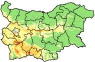
Map of Municipality Borino »
Location
РЕМОНТИ Смолян
