Village Davidkovo
 The village of Davidkovo is located in Central Rhodope Mountains of South-Central Bulgaria and belongs to Municipality Banite (Smolyan District). The distance to Banite is 15 km, to Smolyan — 66 km, and to the capital city Sofia — 177 km.
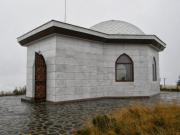
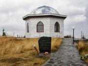
The village has a mixed population of Eastern Orthodox and Muslim Bulgarians. A landmark in the vicinity is Svoboda Peak 13 km to the north, which is an ancient sacred site today worshipped by the Muslim population as the final resting place of the legendary hero Enihan Baba.
Davidkovo has a Bulgarian Orthodox church — the Church of Saint Elijah the Prophet, which is a cultural monument of local importance, and a mosque.
Davidkovo is the crosspoint of different cultural influences. An ancient custom named Davidkovska Poprelka is continuing to this day and the local Rhodopean folk dress is regarded as particularly colourful and beautiful. Davidkovo, as part of the Rhodopes, is also known for its particular folk music.
Quick facts about Village Davidkovo
In Bulgarian (Native transliteraion): Село ДавидковоOther transliteration(s): Davitkovo
Region: South-Central planing region of Bulgaria
District: Smolyan district
Municipality: Banite municipality
Latitude: 41.6669998
Longtitude: 24.9669991
Altitude: from 1000 to 1000
Distance by air to the capital city Sofia: 176.765km
Area Size: 17.16km2
Population: 667 people (31.12.2013)
Postal Code: 4944
Phone Code: 03020


