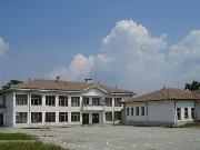
Municipality Chavdar
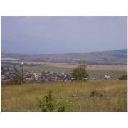
 The Chavdar municipality is located in South-West Bulgaria, Sofia District (in the Zlatitsa - Pirdop hollow). The Municipality consists of 1 village - village of Chavdar. It is situated 3 km to the south of main road 1-6 Sofia - Bourgas, which ensures direct access to the capital city and other neighboring municipalities and regions. An important transport facility is also road III - 37 Etropole - Panagyurishte, which goes through Zlatitsa and connects Northern and Southern Bulgaria via the Zlatishki pass. To the north it is surrounded by the Balkan Range, and to the south - by Sredna Gora Mountain. The average altitude of Chavdar Municipality is 570 m above sea level. Chavdar Municipality is one of the smallest in Bulgaria.
Quick facts about Municipality Chavdar
In Bulgarian (Native transliteraion): Община ЧавдарRegion: South-Western planing region of Bulgaria
District: Sofia district
Municipality: Chavdar municipality
Latitude: 42.6500015
Longtitude: 24.0499992
Altitude: 6
Area Size: 73.23km2
Population: 1311 people (2005)


