Municipality Zemen
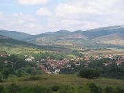
 The Zemen Municipality is part of Pernik District. It is 42 km to the southwest of Pernik and 70 km away from Sofia. The town of Zemen is located in a little trough along the valley of the Strouma River and has semi-mountainous relief. The altitude is 700 m above sea level. The railway from Sofia to Kyustendil /Gyueshevo/ passes through its territory. It is part of the envisaged Transport Corridor No. 8, which is to connect the Adriatic Sea with the Black Sea.
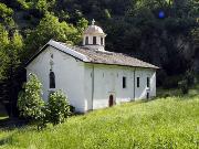
 The most often visited tourist site by both Bulgarian and foreign tourists is the Zemen Monastery. It is 1,5 km from the Zemen Railway Station.
Quick facts about Municipality Zemen
In Bulgarian (Native transliteraion): Община ЗеменRegion: South-Western planing region of Bulgaria
District: Pernik district
Municipality: Zemen municipality
Latitude: 42.4790001
Longtitude: 22.7490005
Altitude: 6
Area Size: 253km2
Population: 3307 people (2005)
Sights & Landmarks Municipality Zemen (7) »
Divlya: Monument Master of Cobbles
Gorna Vrabcha: Monastery "St.Spas" and church of "Ascension"
Jablyano: Zhablyano Monastery
Kalotintsi: Fortress Kalotinsko "Gradishte"
Photos Municipality Zemen (40) »
News Municipality Zemen (2) »
2009-06-26 Monastery St. John the Baptist near village of Jablyano (Culture)
2006-09-13 The Zemen Monastery - Completely different from the XIVc.officials Byzantine and Turnovo school styles (Culture)
External links Municipality Zemen
Info abou Zemen municipality (Zemen)
www.zemen-region.info (Zemen)
Zemen Monastery (Zemen)


