Municipality Kotel
 The Municipality Kotel is located in South-East Bulgaria in Sliven District. The Municipality consists of 1 town (Kotel) and 25 villages. It has well developed communications. There are asphalt covered roads reaching all population centers. The Kotel Pass is an important transport corridor connecting northern and southern Bulgaria. Road II-48 Omourtag - Kotel - Gradets reaches the Petolachkata transport junction from where there are road connections to Bourgas, Sliven, Stara Zagora and Sofia (the Trakia highway, which is under construction), Straldzha railway station, Yambol.
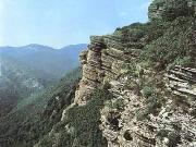
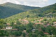
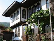
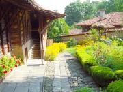
 Kotel is a municipality rich in cultural and historical sights. Five architectural reserves are located on its territory, namely: Galata suburb in Kotel town, Zheravna village, Medven village, Gradets village and Katounishte village. There are 780 declared monuments of culture. The area of Kotel Municipality is environmentally clean because there are no large industrial companies to pollute the environment. The natural sights and protected areas and reserves offer an opportunity for development of ecotourism. These are: Orlitsa reserve, the protected areas Orlovi Skali, Demir Kapia, Korenik, Vida peak, the caves Lednika, Prikazna, Maarata, Karvava Lokva, Tsarevets, the rock formation Ouroushki Skali and Izvorite forest park.
Quick facts about Municipality Kotel
In Bulgarian (Native transliteraion): Община КотелRegion: South-Eastern planing region of Bulgaria
District: Sliven district
Municipality: Kotel municipality
Latitude: 42.8829994
Longtitude: 26.4500008
Altitude: 6
Area Size: 858.306km2
Population: 26916 people (2005)
Sights & Landmarks Municipality Kotel (11) »
Jeravna: Architectural reserve Zheravna
Yablanovo: Complex of Turbes
Kipilovo: Fortress Kipilovo kale
Kotel: Natural History Museum Kotel
Jeravna: Festival of folk costume (August)
Ticha: Church "St.Prophet Elijah"
Ticha: Koyo camii mosque
Photos Municipality Kotel (139) »
News Municipality Kotel (9) »
2009-08-20 Traditional folk costume festival take place in Zheravna (Culture)
2009-06-01 The Fortress Kipilovo Kale (Culture)
2009-04-03 The first Bulgarian Renaissance school textbook stolen from Kotel museum (Accidents)
2009-03-21 Cistern-truck overturns on the junction Kotel - Neykovo (Accidents)
2008-08-21 In Jeravna Wearing Traditional Costumes Is a Must (Culture)
2008-06-13 French Documentary About Bulgarian Disabled Children Is a Lie (Society)
2008-06-10 Hidden Cam Documentary about Bulgarian Children Home Shocks Europe Again (Society)
2008-04-04 Bodies of drown kids found (Accidents)
2007-12-05 Kotel: the pearl of Eastern Balkan Range (Travel)
External links Municipality Kotel
www.kotel.bg (Kotel)
www.jeravna.com (Jeravna)
nu-n-bozveli.my-rpg.com (Malko selo)
neikovo.com (Neykovo)


