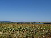
Village Durankulak
 The village of Durankulak is located in North-East Bulgaria. It is part of Shabla Municipality, Dobrich District. It is the most northeastern point in Bulgaria and is situated 6 km south of the Bulgarian-Romanian border and 82 km north from Varna. Nearby is located the Dourankoulak swamp which is a preserved area rich of rare plant species. The region specializes in the production of sunflower, wheat and barley. Two kilometers north from the village, at the shore of Black Sea is located the Cosmos camping zone. Within the Dourankoulak swamp is located an island with area of 17 decare where the only prehistoric hill is situated in the region of southeast Dobroudja inhibted during the neolith.
Quick facts about Village Durankulak
In Bulgarian (Native transliteraion): Село ДуранкулакOther transliteration(s): Dourankoulak, Dourankulak, Durankoulak, Dourankolak
Region: North-Eastern planing region of Bulgaria
District: Dobrich district
Municipality: Shabla municipality
Latitude: 43.7000008
Longtitude: 28.5170002
Distance by air to the capital city Sofia: 436.357km
Area Size: 29.351km2
Population: 375 people (31.12.2013)
Postal Code: 9670
Phone Code: 05748
Sights & Landmarks Village Durankulak (2) »
Durankulak: Durankulak lake
Durankulak: Durankulak beaches
Photos Village Durankulak (11) »
News Village Durankulak (2) »
2009-06-01 Temple of Great goddess-mother Kibella on the big island in the Durankulak lake (Culture)
2008-09-02 Gas Field In Northeast Bulgaria Burning (Accidents)
External links Village Durankulak
durankulak.net (Durankulak)


