
Municipality Zavet
 Zavet municipality is situated in the northeastern part of Razgrad District and is a part of Loudogorie Mountain. Its territory is crossed by road II-23 Rousse - Isperih - Dobrich, road III-4902 Razgrad - Pobit Kamak - Ostrovo - Zavet - Toutrakan, road III-214 Toutrakan - Isperih, as well as forth-class roads connecting the population centers in Zavet municipality. The nearest railway stations are in Isperih town (18 km), Razgrad (35 km), Rousse city (70 km); the nearest ports are: Toutrakan town (40 km), Rousse city and Silistra city (70 km).
 Hunting tourism with shooting game for trophies mainly for foreigners is developed by the Voden Representative Large-Game Unit, which occupies an area of 150, 000,000 sq. m of forests, water areas and pastures in the lands of the municipalities of Razgrad, Zavet, Isperih, Glavinitsa, and Toutrakan.
Quick facts about Municipality Zavet
In Bulgarian (Native transliteraion): Община ЗаветRegion: North-Central planing region of Bulgaria
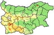
District: Razgrad district
Municipality: Zavet municipality
Latitude: 43.7669983
Longtitude: 26.6669998
Altitude: 4
Area Size: 273.88km2
Population: 15243 people (2005)
Photos Municipality Zavet (16) »


News Municipality Zavet (4) »
2010-08-24 Case of Antrax in village of Brestovene (Health)
2009-10-21 The owner of Sushevo dog-killer shelters 7 puppies and 14 older dogs (Accidents)
2009-10-20 5-year-old girl killed by dog in village of Sushevo (Accidents)
2008-04-23 Tornado stroke villages in Northeastern Bulgaria (Weather)
External links Municipality Zavet
www.zavet-bg.com (Zavet)
www.zavet.dir.bg (Zavet)
Map of Municipality Zavet »
Location
РЕМОНТИ Разград
